H THE SAINI REALTY HomeSmart PV & Associates 📞 +1 (669) 254-6129
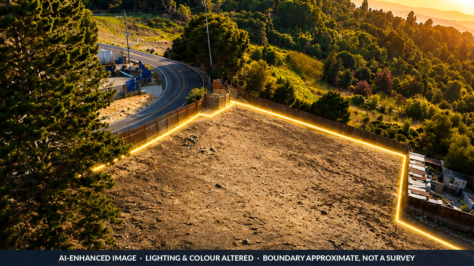
AI-enhanced marketing image of the 3.07 acre Hillcrest Road parcel in El Sobrante, with the approximate boundary highlighted — lighting and colour have been altered and the boundary is not a survey
◆ AI-enhanced image · lighting altered · boundary approximate
Land · 3.07± Acres · HE-C · Housing Permitted By Right

Three Acres Above the Dam Road, Already Zoned for Housing

Hillcrest Road · El Sobrante, CA 94803 · Unincorporated Contra Costa County · APN 420-090-029

Offered at $1,300,000 $423,000 per gross acre
3.07±Acres Per Assessor
HE-CNo Rezone Required
7–17DU Per Net Acre
Zone XOutside FEMA Flood Hazard
★★★★★ Rated 5/5 by every client · Land & new-construction specialist · Site access by appointment

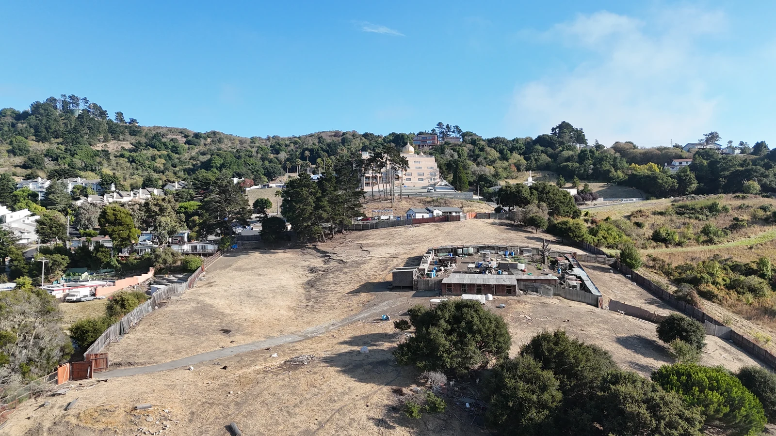
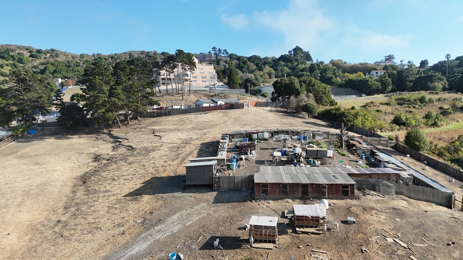
The image above is our marketing image for this listing. It is built from a real drone photograph of the property, but the lighting and colour have been altered and the boundary line is a drawn approximation, not a survey. Every image in the gallery below is unretouched drone photography of the site exactly as it stands today.

$1,300,000Offering Price
$423,000Per Gross Acre
HE-COrd. 2024-02
By RightResidential Permitted Use

The Offering

Contra Costa County Has Already Zoned This Parcel for Housing.

Hillcrest Road is a 3.07± acre hillside parcel in unincorporated El Sobrante, immediately south of San Pablo Dam Road and directly opposite the Sikh Center of the San Francisco Bay Area. It carries the Housing Element Consistency (HE-C) combining district adopted under County Ordinance 2024-02, under which residential development at 7 to 17 dwelling units per net acre is a permitted use. No rezone. No conditional use permit.

Permitted use is not the same as a CEQA exemption, and we would rather you hear that from us than from your land-use counsel. A for-sale project still needs a subdivision map, design review and a grading permit, and those ordinarily carry CEQA with them. There are two ways through: a project setting aside at least 20 percent of its units for lower-income households is processed ministerially under Government Code 65583.2(i), which removes CEQA entirely — or a market-rate project relies on the 2025 AB 130 infill exemption. Both routes are laid out in full below.

What a buyer is acquiring: an unentitled but favourably zoned infill site with a completed third-party planning screen — not an approved project. The single governing unknown is net developable area. The by-right density band applies to net acreage, and net acreage has not been established. Roughly 94 percent of the parcel maps in a 30 to 50 percent slope class, above the County's 26 percent suitability threshold, while the finer elevation data returns a 19.9 percent average. A LiDAR slope-band analysis resolves it. We have not commissioned one, and we are not representing a unit count.

Request the Full Offering Memorandum →

Property Facts

  • AddressHillcrest Road
    El Sobrante, CA 94803
  • APN420-090-029
  • JurisdictionContra Costa County, unincorporated
  • General PlanResidential Medium (RM)
    7–17 du per net acre
  • ZoningHE-C Combining District
    Ord. 2024-02 · mixed-use not permitted
  • Acreage3.07± per Assessor
    Net developable area not established
  • Elevation113.9 – 232.8 ft · 118.9 ft relief
  • Slope19.9% average · 4.5% – 40.6%
  • FloodFEMA Zone X
  • Planning ScreenCox Planning Solutions · 13 Aug 2026

Why It Trades

Six Reasons a Builder Should Look at This

🏷️

Zoned

HE-C combining district. Residential at 7–17 du per net acre is a permitted use — no rezone and no conditional use permit required.

⚖️

Two CEQA Paths

Ministerial and CEQA-free via a 20% lower-income set-aside, or market-rate under the AB 130 infill exemption. The choice is yours to make.

📈

Bonus-Eligible

State Density Bonus Law as amended by AB 1287 adds units, concessions and waivers of development standards — valuable on a hillside.

🌊

Out of Flood

FEMA Zone X. No 1-percent-annual-chance flood area and no regulatory floodway mapped on the property.

📍

Real Infill

Established residential on three sides, San Pablo Dam Road retail a short walk north, and Interstate 80 about a third of a mile west.

📋

Screened

A third-party planning and entitlement screen is already complete and goes into the data room with the offering package.

Property Images

The Site Exactly As It Stands Today.

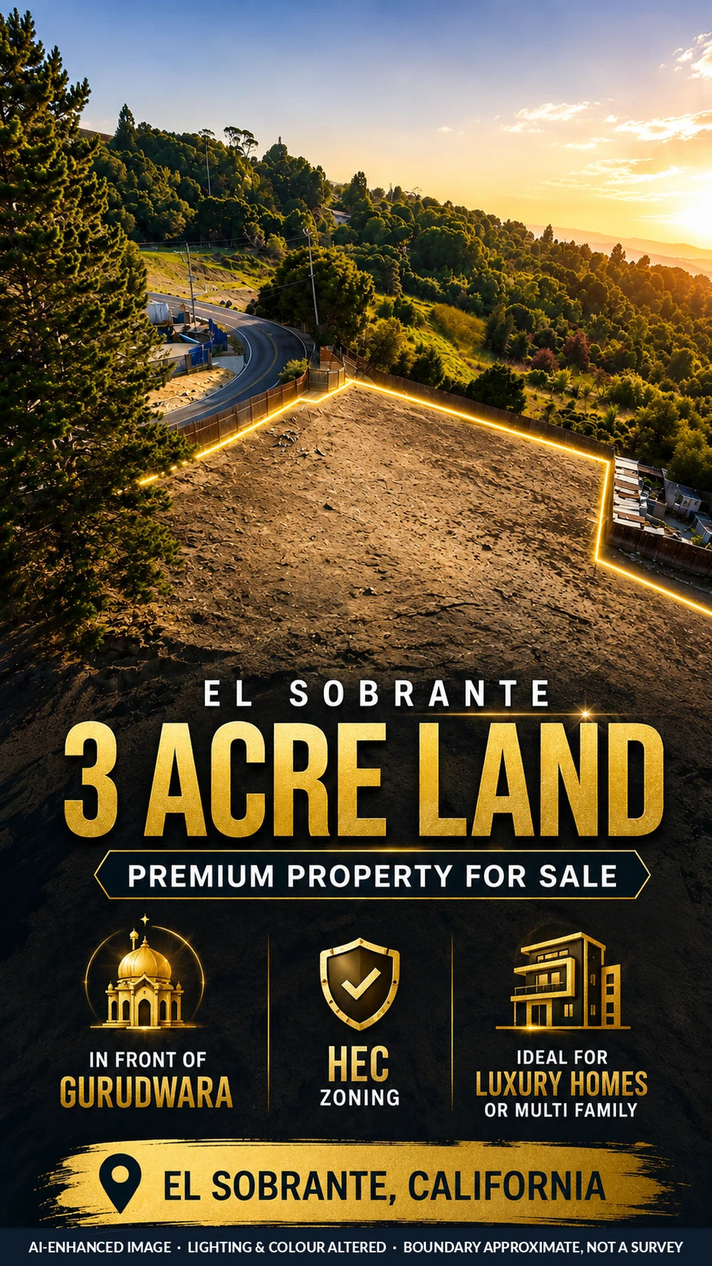
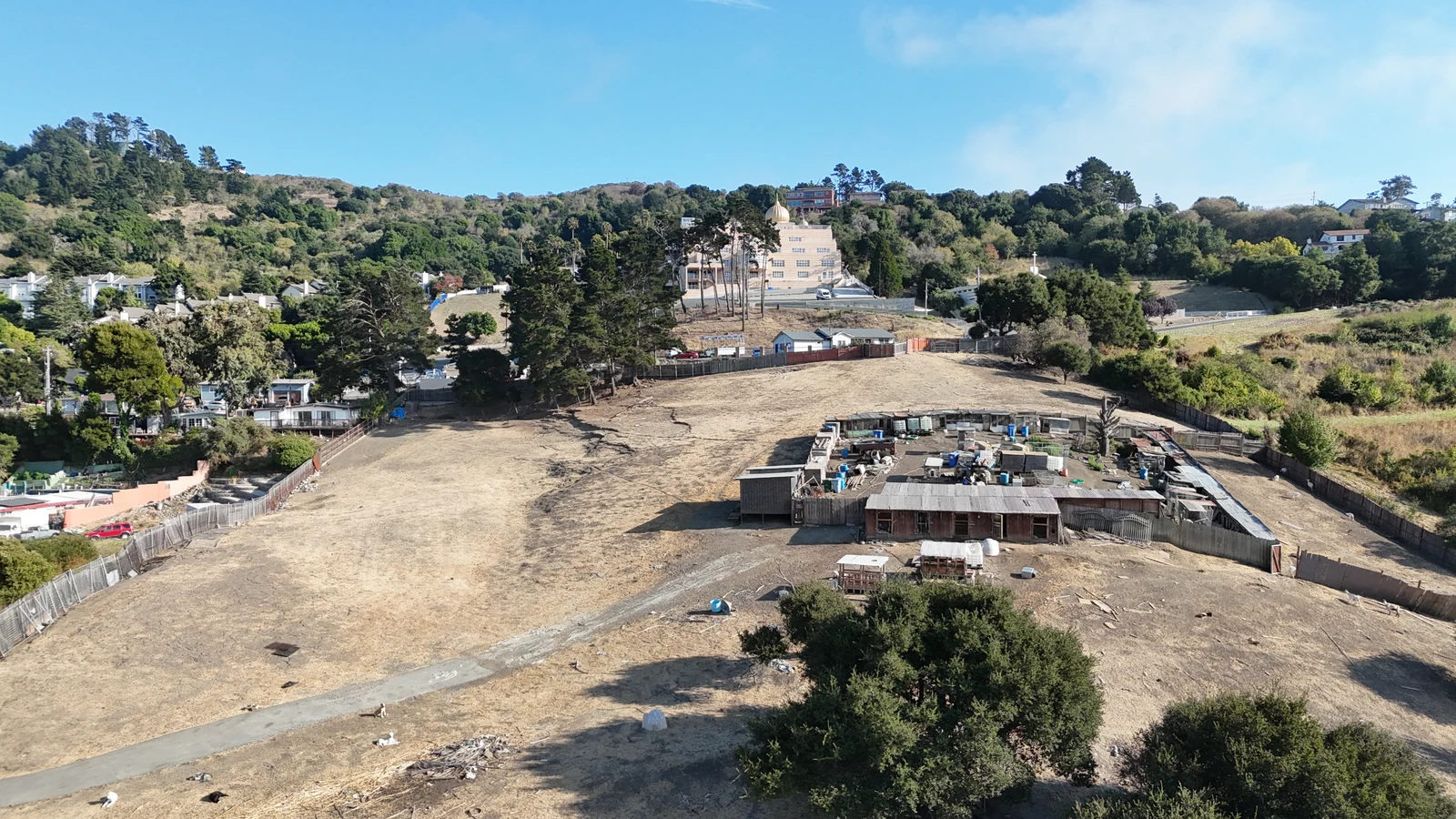
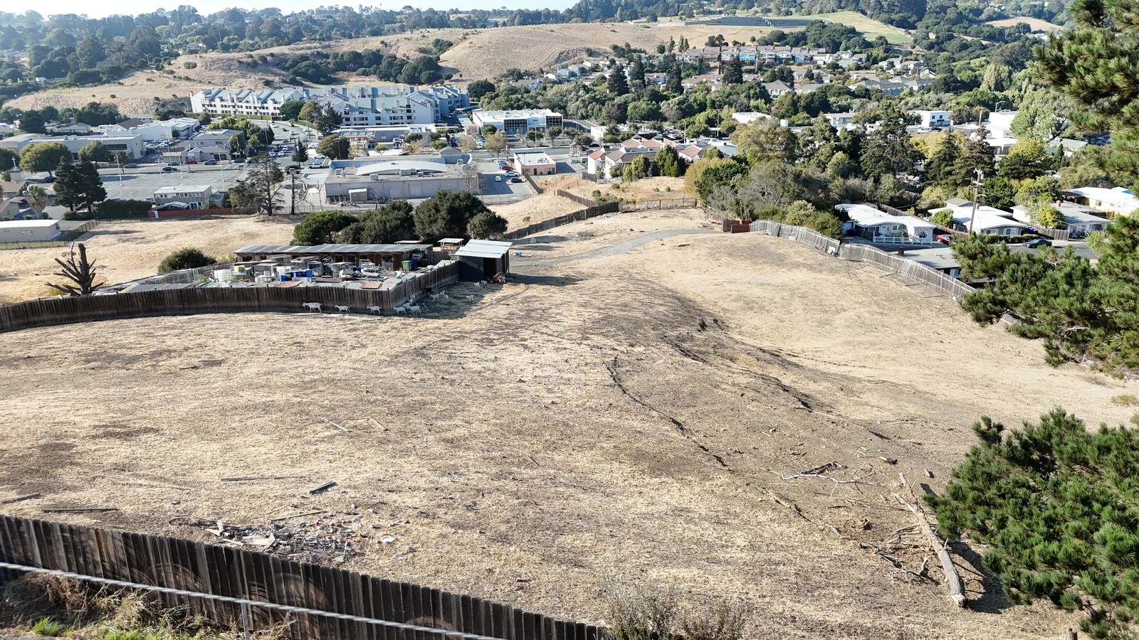
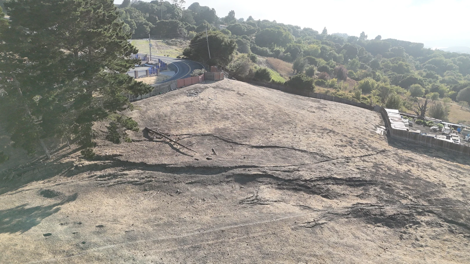
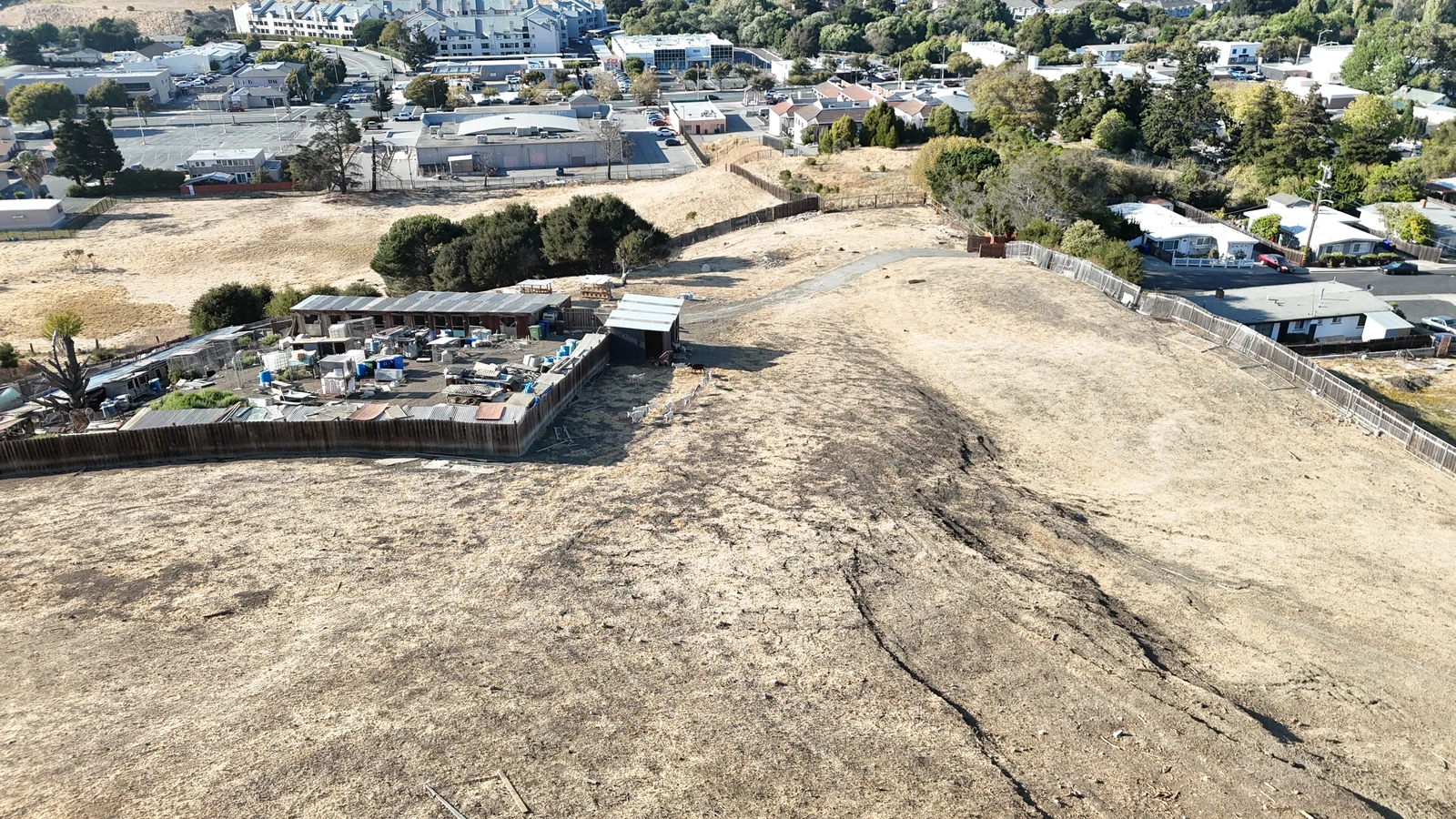
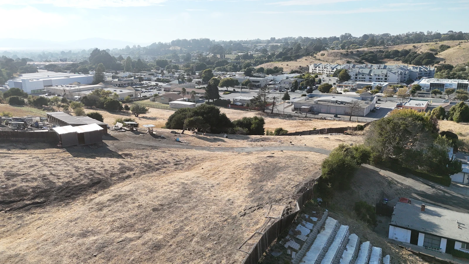
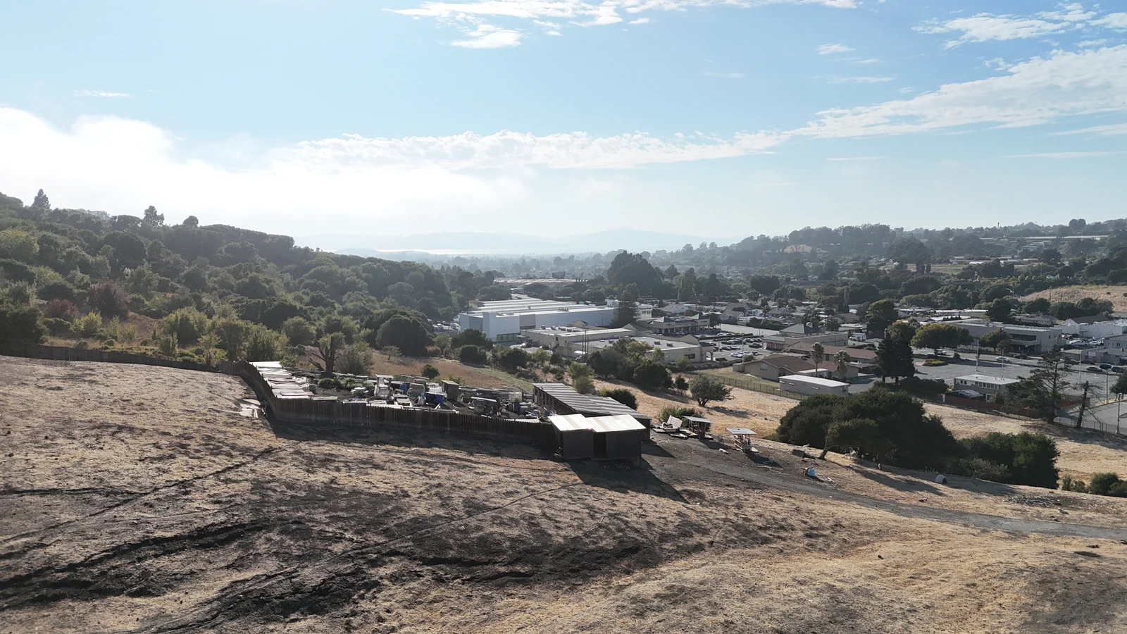
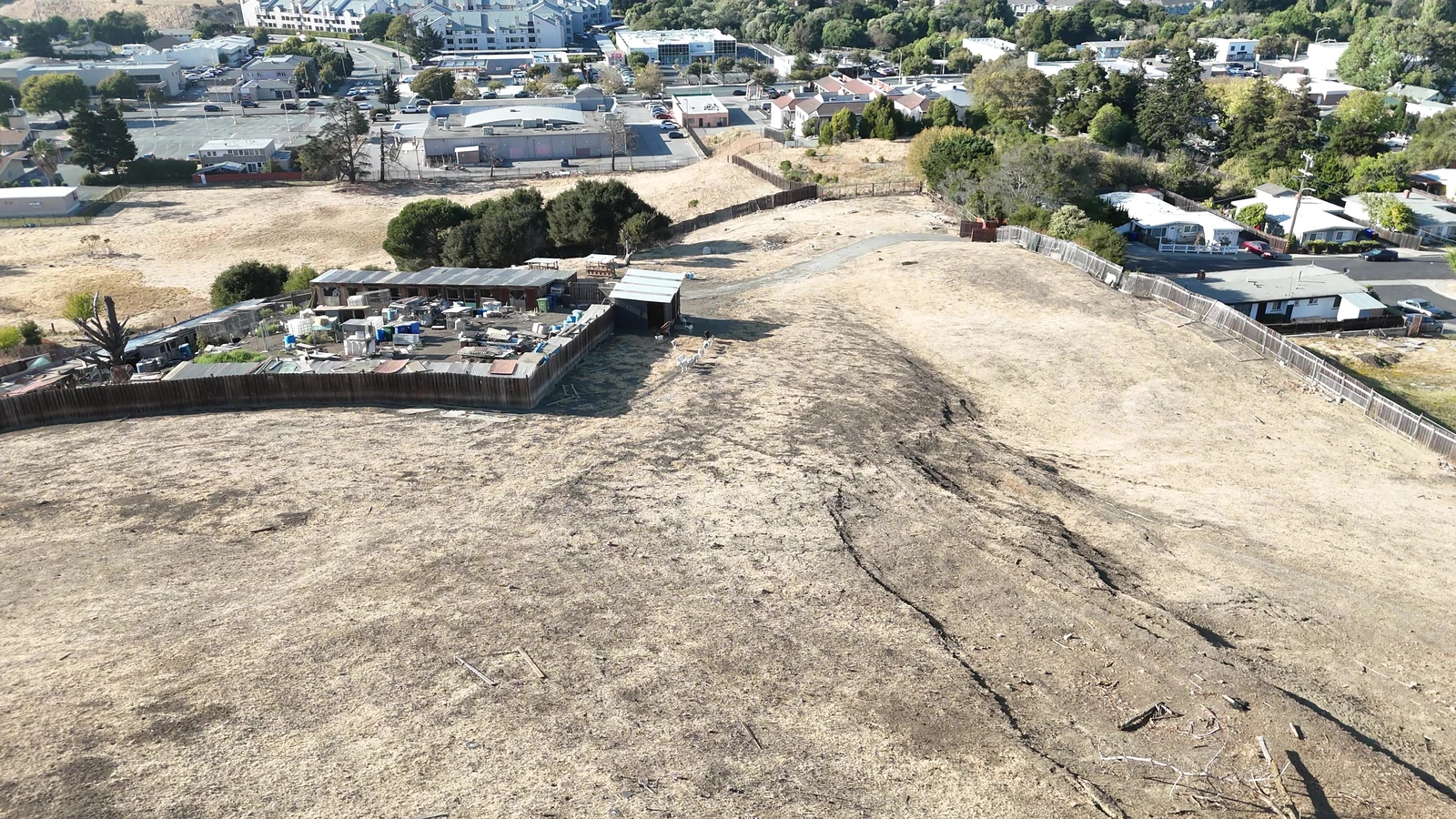
The first two images are our marketing flyer and its cover — built from a real drone photograph with the lighting altered and the boundary drawn on. Every image after them is unretouched drone photography captured on 7 August 2026, including the informal structures, pens and livestock currently on the eastern portion of the site. Nothing has been cleaned up for the camera.

The lead image is an AI-enhanced marketing image produced by The Saini Realty from a drone photograph of this property; the lighting and colour have been altered and the highlighted boundary is a drawn approximation, not a survey. It is not a rendering of any proposed development and no homes have been designed or approved. All other images are unretouched drone photography captured 7 August 2026. Parcel boundaries are not shown on the unretouched photography and areas visible in frame extend beyond the subject parcel.

Characteristics

  • TopographyHillside · broad central bench
  • Elevation113.9 – 232.8 ft · 118.9 ft relief
  • Slope19.9% average · 4.5% – 40.6%
  • County Threshold26%+ generally unsuitable
  • SoilsLos Osos clay loam, 30–50% slopes
    94.4% of site · Botella clay loam on 0.2 ac
  • FloodFEMA Zone X · outside the SFHA
  • Aquatic FeatureEphemeral drainage, NW corner
  • Prior GradingMass-graded circa 2015 · permit status unconfirmed
  • AccessHillcrest Road frontage, southern boundary

Surrounding Uses

  • NorthVacant land · San Pablo Dam Rd retail beyond
  • EastEstablished single-family residential (R-7)
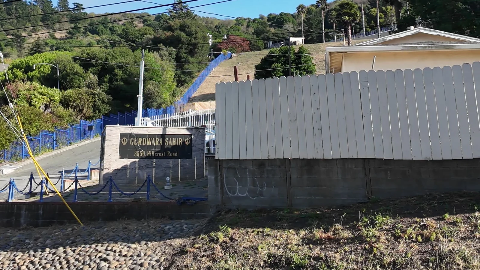
  • SouthHillcrest Road · Sikh Center Gurdwara Sahib
  • WestVacant land and institutional use
Site condition — please read this. The Assessor classifies the parcel as vacant residential and carries no improvement value on the 2025 roll. Drone photography taken 7 August 2026 shows the eastern portion in active informal use: fenced pens, metal-roofed outbuildings, stored materials and containers, an unpaved interior drive, scattered debris and livestock. Historical imagery also shows the circa-2015 mass grading and an older foundation. Permit status for the structures and the grading, any lease or licence covering the current use, and responsibility for removal and clearance are all unverified. Delivery of the site free of occupants, animals, structures and debris is a matter for negotiation and is not represented here.

Entitlement

Permitted Use, and Two Ways to Clear CEQA.

The regulatory door is open. The strategy turns on affordability, and feasibility turns on net developable area.

Regulatory Position

  • General PlanResidential Medium (RM)
  • Density Band7–17 du per net acre
  • ZoningHE-C · Ordinance 2024-02
  • Residential UsePermitted by right
  • Rezone RequiredNo
  • Use Permit RequiredNo
  • Mixed UseNot permitted
  • Net Developable AreaNot established
  • Subdivision MapNot filed
  • Aquatic DeterminationField verification required
  • Grading Permit HistoryTo be confirmed

Source. General Plan designation, HE-C zoning, density band, CEQA pathways, slope, soils, flood and drainage findings per the Preliminary Screening Report prepared for The Saini Realty by Cox Planning Solutions, dated 13 August 2026. That report is expressly based on desktop and available record data; mapped conditions are indicators, not field-verified findings. Cox does not guarantee permit approvals or valuation outcomes.

By right is not the same as CEQA-exempt. CEQA attaches to discretionary approvals, not to zoning. A ministerial approval — one granted by applying fixed, objective standards without discretion — is not subject to CEQA under Public Resources Code 21080 and CEQA Guidelines 15268. Building here by right removes the rezone and use-permit hurdles, but a for-sale project ordinarily still requires a subdivision map, design or site-plan review, and a grading or hillside permit.
Path one — the affordability switch. Under Government Code 65583.2(i), a jurisdiction must process a qualifying Housing Element inventory site ministerially and by right when at least 20 percent of the units are affordable to lower-income households, and the HE-C ordinance carries that condition. A ministerial approval involves no discretion, so CEQA does not apply and the discretionary review path falls away with it. The cost is deed-restricted pricing on a fifth of the units.
Path two — the market-rate route. Without the set-aside the project stays discretionary and CEQA applies unless an exemption is available. The 2025 infill exemption under AB 130 fully exempts qualifying infill housing, and this parcel meets the size, urbanised-location and consistency tests and lies outside the FEMA Special Flood Hazard Area. AB 130 excludes sites containing wetlands or protected-species habitat, and that exclusion is site-based rather than footprint-based — so eligibility turns on the field determination of the northwest-corner drainage, not on avoiding it. If the drainage were the only disqualifying condition, SB 131 (2025) allows CEQA review limited to that single issue rather than a full EIR, and CEQA Guidelines 15332 remains available as an alternative in-fill categorical exemption.

Density Bonus — Moderate Income, For Sale

  • 10% set-aside+5% units
  • 20% set-aside+15% units
  • 30% set-aside+25% units
  • 44% set-aside+50% units · current maximum base bonus

Government Code 65915(f)(4) as amended by AB 1287 (2024). Beyond the 50 percent maximum an additional stackable bonus is available, and a density bonus project is separately entitled to concessions and to waivers of development standards — which on a constrained hillside can be worth as much as the added units. County inclusionary requirements should be confirmed separately, as they may apply independently of these state tools.

Density & Yield

Net Developable Area Is the Number That Matters.

The by-right density band applies to net acreage, and net acreage has not been established. Soil mapping places about 94 percent of the parcel in a 30 to 50 percent slope class, above the County's 26 percent suitability threshold, while the finer elevation data returns a 19.9 percent average — indicating moderate pockets the coarse soil unit does not capture. The true figure lies between those two readings.

Illustrative Only — Not a Represented Unit Count

  • Gross Site Area3.07± acres per Assessor
  • By-Right Band7 – 17 du per net acre
  • Band × Gross Acreage21 – 52 units · theoretical ceiling
  • Net Developable AreaNot established — governs actual yield
  • Screening Illustration Base24 units (assumed)
  • At a 21-unit base±$62,000 per unit
  • At a 24-unit base±$54,000 per unit
No unit count is represented. The figures at left are arithmetic applied to gross acreage and to an assumed base, shown to frame the range only. Actual yield depends on net developable area after slope, geotechnical and drainage setbacks, on the housing product selected, on the entitlement path chosen, and on County review. Neither the broker nor the seller represents that any particular number of units is achievable, and no site plan, subdivision map or architectural design exists for this property. Purchasers must reach their own conclusions.
The first work item. A LiDAR-based slope-band analysis quantifying buildable area under the County's 26 percent threshold, with the drainage and preliminary aquatic setbacks overlaid, converts this from a zoning story into an underwriting. It has not been commissioned. Whoever runs it first — buyer or seller — will know more than the market does.

Site Constraints

What Is Known, and How Well.

Findings below are drawn from the third-party planning screen. Mapped conditions are indicators, not field-verified findings. Confidence reflects the strength of the underlying record — High: strong data, low unknowns. Medium: reasonable inference with open items. Low: meaningful unknowns, targeted verification recommended.

Topography · Medium. Hillside, average slope near 20 percent with a range of 4.5 to 40.6 percent, and a majority mapped above the County's 26 percent suitability threshold — the standard used in its 65/35 Land Preservation program. Net developable area is the governing unknown.
Soils & geotechnical · Medium. Los Osos clay loam on 30 to 50 percent slopes across roughly 94 percent of the parcel. That soil-and-slope combination raises expansive-soil and slope-stability considerations. A design-level geotechnical investigation will govern where and how much can be built and is the primary cost driver on a hillside site.
Drainage & aquatic · Low. Federal and state mapping show a linear drainage feature and no mapped wetland polygons. On a preliminary basis it is best characterised as an ephemeral drainage concentrated at the low northwest corner — the parcel's topographic outlet — rather than a defined vegetated watercourse crossing the buildable area. Following Sackett v. EPA (2023) an ephemeral, possibly graded swale in uplands is a weak candidate for Clean Water Act jurisdiction, but the State Water Board and CDFW reach further. Minor and avoidable in site design on the available evidence; jurisdiction is a field determination.
Flood · High. FEMA Zone X, outside the Special Flood Hazard Area. No 1-percent-annual-chance flood area and no regulatory floodway mapped on the property. The stippled feature on the property report's flood exhibit is the wetlands overlay, not a flood-zone designation.
Prior grading · Low. The site was mass-graded circa 2015 and an older foundation is visible in historical imagery. Whether that grading — and any alteration of the drainage — was permitted is unconfirmed and should be verified with the County and, if applicable, the resource agencies. Unpermitted grading can carry an enforcement or restoration obligation and affects the environmental baseline for later review.
Current occupancy · Low. August 2026 drone photography shows informal structures, pens, stored materials and livestock on the eastern portion, notwithstanding the Assessor's vacant residential classification. Permit status, tenancy and clearance responsibility are unverified, and a Phase I Environmental Site Assessment is recommended.

Utilities & Agencies

Service Providers — Availability To Be Confirmed.

The providers below are the agencies whose service areas cover unincorporated El Sobrante. No will-serve letter, capacity study, connection point or main location has been obtained. The third-party screening was a planning and environmental review and did not extend to utility engineering.

  • Domestic WaterEast Bay Municipal Utility District
  • Sanitary SewerWest County Wastewater District
  • Electric & GasPacific Gas & Electric
  • Fire ProtectionContra Costa County FPD · Station 69
  • Storm DrainageCCC Flood Control & Water Conservation District
  • Roads & GradingContra Costa County Public Works
  • Planning AuthorityCCC Dept. of Conservation & Development
  • School DistrictWest Contra Costa Unified

Utility availability, capacity, precise connection locations, easements, relocation requirements, fees and final agency approvals all remain subject to purchaser verification directly with each agency. Nothing on this page represents that service is available to the site.

Location

El Sobrante, Above the Dam Road.

The site sits on the hillside immediately south of San Pablo Dam Road — the principal arterial through unincorporated El Sobrante, carrying neighbourhood retail, grocery, pharmacy and service commercial. Interstate 80 is roughly a third of a mile west, putting Richmond, Berkeley and the Bay Bridge approach within a straightforward commute, and El Cerrito del Norte BART is about two and a half miles south. The Sikh Center of the San Francisco Bay Area sits directly opposite on Hillcrest Road.

Access & District

  • Interstate 80±0.4 mi
  • San Pablo Dam RoadImmediately north
  • El Cerrito del Norte BART±2.5 mi
  • San Pablo Town Center±0.9 mi
  • Kaiser Richmond±2.9 mi
  • School DistrictWest Contra Costa Unified

Neighbourhood

  • Sikh Center GurdwaraDirectly opposite · ±0.2 mi
  • St Callistus Church±0.1 mi
  • Plaza Sobrante Retail±0.1 mi
  • Bismillah Halal Market±0.2 mi
  • Raley's±0.4 mi
  • El Sobrante Library±0.6 mi

Distances are approximate straight-line measurements from an estimated site centroid and should be independently verified. School district shown is the district serving unincorporated El Sobrante; individual school assignment is set by district boundary and should be confirmed with West Contra Costa Unified.

Due Diligence

Open Items, Stated Plainly.

This is an unentitled site with a completed planning screen. The items below are the ones that will decide whether a scheme pencils — published here rather than saved for the disclosure packet.

📐

Net Developable Area

Unestablished, and it governs yield. A LiDAR slope-band analysis is the first work item.

🪨

Geotechnical

Design-level investigation required. Expansive clay on 30–50% slopes is the primary cost driver.

💧

Aquatic Determination

Field delineation of the northwest drainage. This governs AB 130 eligibility and sets the buffers.

🚜

Prior Grading

Permit history and any open enforcement to be confirmed with Contra Costa County.

🧪

Phase I ESA

Recommended, particularly given the current informal use of the eastern portion.

📜

Title & Survey

Preliminary title not yet obtained. Acreage and boundary are per Assessor and public mapping, not a survey.

🔌

Utilities

No will-serve letter or capacity confirmation has been obtained from any agency.

🐐

Occupancy & Clearance

Structures, pens, materials, debris and livestock are present. Removal responsibility is a negotiated term.

💵

Fees

County, school, park and agency fee exposure has not been quantified.

What we have and have not done. Neither the broker nor the seller has conducted a geotechnical investigation, an environmental site assessment, a survey, a utility study, or a biological or aquatic delineation. What exists is the third-party planning screen, the Assessor and County mapping exhibits, historical and current aerial photography, and the Offering Memorandum. All of it goes into the data room. Everything else on the list above is open, and we would rather you price it than discover it.
Harp Saini, The Saini Realty

Exclusively Marketed By · DRE# 02165868

Work Directly With Harp Saini

A results-driven agency specializing in listing, marketing and delivering maximum value for every seller. Harp Saini represents buyers and sellers across Sacramento, Elk Grove, Roseville, Antelope and the surrounding Central Valley, with land and development assignments across Northern California, under HomeSmart PV & Associates.

  • Straight answers — the open items on this deal are published above, not buried
  • Direct access to the seller and the full third-party screening report
  • Personal circulation to regional builders, developers and land investors
  • Site tours arranged by appointment, evenings and weekends included
  • When you call, you get Harp — not a call center, not a hand-off

Office 916-888-9877  ·  Cell 669-254-6129
Email harp@thesainirealty.com

📞 Call or Text Harp — +1 (669) 254-6129 💳 Save My Digital Card

How We Work

Honest Information, Modern Tools.

We would rather lose a deal than win one on a half-truth. On this listing that means the unestablished net developable area, the unconfirmed grading permit history, the livestock and structures currently on the site, and the field determination that governs CEQA eligibility are all printed on the page. And it means telling you plainly which images are photographs and which have been enhanced.

🤝

Honesty first

What we know, we tell you. What we do not know, we label as unconfirmed and point you to the agency that can confirm it. No pressure, no polish over problems.

📄

Sourced, not guessed

The zoning, slope, soils, flood and CEQA findings here trace to a Preliminary Screening Report prepared by Cox Planning Solutions dated 13 August 2026. Where that report labels something Low confidence, so do we.

🤖

AI, disclosed

We use AI and modern visualization to market land faster and reach the right buyers. Any AI-generated or AI-enhanced image on our listings is labelled on the image itself — never passed off as an unedited photograph.

🔍

Verify everything

We hand you the documents and encourage independent verification with the County, your engineer and your title officer. A buyer who checks our work is a buyer we want.

The Saini Realty Standard

Known for Out-Marketing the Competition at Every Price Point.

Every listing gets professional media, paid campaigns, a dedicated property site, and direct circulation to the buyers most likely to transact.

📸

Exceptional Media

HDR photography, cinematic video and drone coverage on every listing.

🚀

Paid Campaigns

Targeted social and search advertising with retargeting, placing the property in front of active buyers and builders.

📱

10K+ Community

Over 100K video views across Instagram · YouTube · TikTok · Facebook.

🤝

Direct Outreach

Personal circulation to regional builders, developers and land investors alongside MLS, CoStar and Crexi syndication.

★★★★★

Next Step

Request the Offering Memorandum & Data Room

The full package — the Offering Memorandum, the Cox Planning Solutions Preliminary Screening Report, the Assessor parcel map, County General Plan and zoning exhibits, soils, elevation and FEMA exhibits, and historical and current aerial photography — is released on execution of a confidentiality agreement. Tell us who you are and we'll send it the same day.

Site access is by appointment only. Livestock and unsecured structures are present and the site is not open for unaccompanied inspection. Offers in writing with proof of funds or lender commitment.

📞 +1 (669) 254-6129

Request the Package

Takes 20 seconds. We'll confirm by text and send the documents.

Your info goes directly to Harp — not a call center.

Keep Exploring

Not the Right Project? We'll Find It Together.

Browse our full collection of hand-selected listings, run mortgage and affordability calculators, and see how we market every property we touch.

Visit TheSainiRealty.com → 💳 Save My Digital Card

Seen on social

See the work before you call

Real walkthroughs and market updates from our own channels — not stock footage, not AI. Tap any card to watch it here; nothing loads until you do.

More on Instagram, TikTok and YouTube — @panjabirealestate.

What clients say

★★★★★

Hear it from a client in her own words, not ours.

Client review · The Saini Realty · Harp Saini, DRE# 02165868

Watch the full review ↗
📞 Call Now Get the OM